There it is! The first plug from The National Water Management Authority is ready for download.
30 marca 2022 r.
The National Water Management Authority has released the first plug-in for the QGIS software called "Wody Polskie - WMS Base". It collects all WMS (Web Map Services) browsing services published by The National Water Management Authority in one place and allows you to load them into QGIS with a single button. To make it easier, the services have been grouped in 6 thematic tabs.
The available thematic tabs:
• Map of the Hydrographic Division of Poland in the scale of 1:10 000 (MPHP10k),
• Update of the Water Management Plans (aPGW),
• Organizational units of The National Water Management Authority (PGWWP Borders),
• Preliminary Flood Risk Assessment (WORP),
• Flood Hazard Map (MZP),
• Flood Risk Map (MRP).
The plugin "The National Water Management Authority – WMS Base" can be downloaded from the QGIS repository. In the current version 1.0.1, there are 28 WMS browsing services available, which gives a total of over 400 thematic layers. The author of the tool is Łukasz Ścisłowski – chief specialist in the Department of the Water Management Information System in the National Water Management Board in Warsaw PGW WP.
In order to obtain the above resources in the form of lists, map compositions or vector data, we encourage you to read the information on our website:
https://wody.gov.pl/strefa-klienta/110-strefa-klienta/1677-udostepnianie-danych-z-systemu-informacyjnego-gospodarowania-wodami-2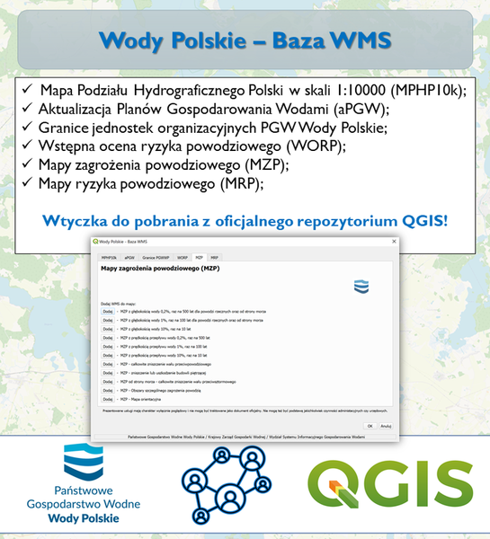
Rest news
- Polish Waters Authority have obtained a grant from the European Union to develop the projects for the third update of drafts of the 3rd Update of River Basin Management Plans
- World Water Day 2022 under the slogan "Making the invisible visible"
- The validity period of the 2016 water management plans was extended until 22.12.2022.
- From plans to action - what awaits the water management in Poland?
- We will not improve the status of water without specific actions
- Public consultations IIaPGW and aPZRP: over 2,000 applications in order to ensure security against flooding and good water condition!